| Subject: | Re: Garmin GPS II+ in Vanagon |
| From: | Steve Green |
| Date: | Wed, 18 Apr 2001 16:54:29 -0700 |
I use a program called "GPS Utility" -- http://www.gpsu.co.uk/
It works pretty much as you describe it.

I also use Delorme Street Atlas USA which has street maps of the entire US and a GPS interface. I doesn't cover Canada, but I assume that there are equivalent programs up there. Most such mapping programs now work with GPS's.

See http://joe.mehaffey.com/ for a lot of good GPS info and links.

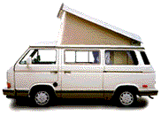
Note that the GPS II fits nicely in the dash in front of the speedometer. I use an external antenna mounted on the lip of the metal cab roof that extends inside the pop top. The GPS signal can penatrate the fiberglass pop top, but not the metal cab. I got the antenna from http://www.gpscables.com/

I got a data & power connector for the GPS II from http://www.blue-hills-innovations.com/ . Garmin sells these too, but they charge an arm and a leg. I glued a phone jack into the speedo cluster and wired it to the van's 12V power and to a seial port connector so I can run the mapping software and follow my location on a laptop.

Steve Green -- Chico, CA
Zefram -- 1984 Wolfsburg Westfalia

On Tue, 17 Apr 2001 21:40:40 -0700, you wrote:

>Anyhow, somewhere I remember reading that there is a software program that
>you can load on your lap top that enables you to make maps.  I remember
>reading that you can scan in a map, define (exactly) three points on the map
>and the computer will then know exactly where you are at (with the aid of
>the GPS).  Does this sound familiar?  Where can I get it?
Have something to add on this topic today? Revive this thread in the forum »