
| Subject: | trip planning software |
| From: | The CiKaspers |
| Date: | Sat, 26 May 2001 15:09:48 -0700 |
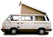
ok, so we've got a syncro westfalia, and we're planning a 24 day driving
trip for august.  we're planning a bit loop, from santa cruz north to
portland, then east to rapid city, sd, then south to santa fe and west back
to santa cruz.

we have to meet friends in rapid city six days after leaving santa cruz, so
that part's going to be pretty fast driving.  we're spending five days in
and around rapid city, then two weeks back to santa cruz through the
rockies and the desert.

i use a mac.  i had a great trip planning software that helped us when we
did our trip two years ago; it is called route 66.  unfortunately it got
corrupted and i can't use it.  the current version of route 66 only has
maps for europe.  what i was able to do was plot waypoints and figure
driving times, distances, and fuel consumption.  it allowed me to plot
routes to fairly fine detail (ok, it didn't have green grass, sd in it, but
it's only five mobile homes at a good river crossing) and i could determine
distances to fillups.

i have tried highway navigator (shareware) and it is lacking.  i am
thinking about going out and getting delorme's street atlas 6.0, but the
delmorme website doesn't tell me enough about it to make me want to
purchase it.  does anyone use it?  does it do the things i am asking for?
is it worth the price?

can anyone make other mac trip planning software recommendations?

happy, safe motoring this weekend, folks.

bill
'87 syncro westfalia
http://www.scruznet.com/~kasper/pics/westy
Have something to add on this topic today? Revive this thread in the forum »