
| Subject: | Re: New mapping program from Google with satellite images |
| From: | Tim Demarest |
| Date: | Fri, 8 Apr 2005 14:29:54 -0400 |
That's pretty cool... I like the detail of the street maps, that big
screen-filling map is *much* better than the tiny travesty MapQuest
displays. I wonder if it will all shrink once Google adds up the bandwidth
cost...

The pointer on the sat-photo is on my neighbors house instead of mine, and
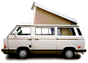
although I can make out my swimming pool easily, I can't make out my Westie
in the driveway... either the resolution isn't quite high enough, or I was
out driving it when the photo was taken.

At 09:41 PM 4/7/2005 -0400, Harold Teer wrote:
>Google has released a new mapping program (beta) with satellite images of
>North America. I just spent an hour working (playing) with it and you will
>be impressed.
>
>It has the normal routing feature of map programs plus satellite images. For
>example, I obtained directions to a destination and in addition to the
>normal directions, I could also see an image of everyplace along the way!
>Hard to explain, but you have to see this and explore the features. I used
>to live in Durango, Co in the last house at the end of a street at the edge
>of town. I just looked up my old address and with the satellite image, could
>pick out my house and see that the whole area behind my house has been
>developed. Not a surprise, but interesting to see.
>
>Planning a trip to EveryBus 2005, Syncro de Mayo Este 2005, BusFusion 2005,
>or elsewhere? Map it out and then see what the route and destination look
>like from the satellite.
>
>See: http://maps.google.com
>
>Enjoy,
>
>Harold
>--
>Harold Teer
>Harrisonburg, VA
>1991 Westy
Have something to add on this topic today? Revive this thread in the forum »