
| Subject: | Wasserputer Mapping Results |
| From: | Matt Barclay |
| Date: | Sun, 18 Sep 2005 23:33:02 -0700 |
The webcam and GPS are up and running!  Have a look at this Google map of
my drive through Seattle to a friends house.  It was night time, so the
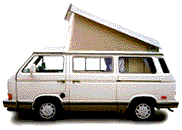
images are pretty dark.  Click on the Vanagon Icon for a thumbnail, then
click on the thumbnail for a full size image.

(Warning: may take a while (up to a minute) to load in your browser)

http://maps.vanagabond.com/sanket/

The vanagon icons are still a little rough and the shadows need work.  Let
me know if it totally sucks on Internet Explorer, I've only tested on
Firefox.

Anybody else using GPS for your trips?  Even if you don't have webcam
images, I could load your trip data into a map like this one.  I was
thinking of making an upload form for plain text GPS data.  I have no idea
what kind of text formats are used by various GPS units, so if you're
interested Pmail me a sample and I'll see what I can do.

Cheers,
Matt
Have something to add on this topic today? Revive this thread in the forum »