
| Subject: | Re: Wasserputer Mapping Results |
| From: | Doug Alcock |
| Date: | Tue, 20 Sep 2005 14:15:04 -0400 |
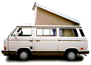
Hi Matt --- opened it in Internet Explorer didn't see any vanagon icons ----
nothing clickable at all actually.
 Cheers,
Doug

 On 9/19/05, Matt Barclay <mbarclay@openfbo.com> wrote:
>
> The webcam and GPS are up and running! Have a look at this Google map of
> my drive through Seattle to a friends house. It was night time, so the
> images are pretty dark. Click on the Vanagon Icon for a thumbnail, then
> click on the thumbnail for a full size image.
>
> (Warning: may take a while (up to a minute) to load in your browser)
>
> http://maps.vanagabond.com/sanket/
>
> The vanagon icons are still a little rough and the shadows need work. Let
> me know if it totally sucks on Internet Explorer, I've only tested on
> Firefox.
>
> Anybody else using GPS for your trips? Even if you don't have webcam
> images, I could load your trip data into a map like this one. I was
> thinking of making an upload form for plain text GPS data. I have no idea
> what kind of text formats are used by various GPS units, so if you're
> interested Pmail me a sample and I'll see what I can do.
>
> Cheers,
> Matt
>
Have something to add on this topic today? Revive this thread in the forum »