
| Subject: | Re: [WetWesties] How To Have Fun With a GPS LVC |
| From: | Mister Tom |
| Date: | Sun, 10 Feb 2008 12:59:50 -0800 |
> >-----Original Message-----
> >From: wetwesties@yahoogroups.com
> >[mailto:wetwesties@yahoogroups.com] On Behalf Of Loren Busch
> >Sent: Sunday, February 10, 2008 9:57 AM
> >To: Wetwesties; Vanagon
> >Subject: [WetWesties] How To Have Fun With a GPS LVC
> >

Yes, there's been quite a bit posted on the GPS devices, but I haven't seen
much on the solution I picked. Sorry if it's been discussed and I missed it.

My new Blackberry Curve has a built-in GPS and I have downloaded Google Maps
for it.  I leave the satellite photo overlay on, as it makes navigation
easier, at least for me.  Cool stuff:  You can search for "pizza" and you
get balloons of the local purveyors with their phone numbers and it will
dial one for you. You can get (non-verbal) driving instructions, but I
haven't found the need for that yet.

It can also display traffic on the freeways as green, yellow or red,
depending on the current average speed.  Good for selecting the best route
home after work.  If it hasn't found the satellites it uses cell towers and
tells you that your position is only accurate to some thousands of meters.
With the satellites it's within 3 meters.

I can't wait to use the GPS and satellite map when we take our kayaks (with
the Vanagon) out exploring again.  I know it doesn't replace the
sophisticated dedicated nav systems, but it surely works for me.  Besides,
it was easier to justify a new phone than a nav system with my "accountant".

Very important:  The red Blackberry Curve matches the Vanagon's Titian Red
color *quite* nicely.

Tom S

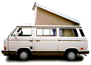
'87 Syncro Westy EG-33
Have something to add on this topic today? Revive this thread in the forum »