
| Subject: | Re: least steep California Sierra Passes/ THANKS! |
| From: | Neil2 |
| Date: | Thu, 31 Jul 2008 12:23:58 -0700 |
Unsure if GEarth does so but a friend told me he did well surveying his
route using a fly by method several thousand feet up.  I tried the same
thing at a low altitude and mistakenly thought the passes I was trying to
judge were low and they weren't :-(

Guess it takes practice to fly google!  YAMV

On Thu, Jul 31, 2008 at 10:14 AM, Michael Diehr <md03@xochi.com> wrote:

> How about the 395 North from reno to lassen park via 89 or 44, then
> over to mt shasta via 89 -- any brutal passes that route?
>
> I wonder if any of the online mapping websites can show driving
> directions with altitude?  Google Earth perhaps?
>

--
Neil2
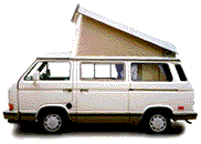
'86 Vanagon/Weekender in process (Savannah)
Nunquam Pendite Divendium
Have something to add on this topic today? Revive this thread in the forum »