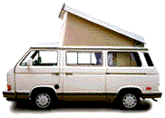
| Subject: | Circumnavigated the Great Salt Lake in Our Westy |
| From: | Tom Buese |
| Date: | Thu, 4 Jun 2009 16:57:57 -0600 |
>>
>> For those w/time to kill, here's a report about our circling the
>> Great Salt Lake over Memorial Day Weekend:
>>
>> http://maps.google.com/maps?f=q&source=s_q&hl=en&geocode=&q=great+salt+lake+Utah&sll=37.0625,-95.677068&sspn=48.688845,78.310547&ie=UTF8&z=9&iwloc=A
>>
>> Original plan, trip to Kodachrome Basin in The Grand Staircase/
>> Escalante National Monument w/some friends & their 91 Westy.
>> Friends' Westy started screeching on the way out of town, so they
>> dropped it off at their mechanics to verify whether it was the
>> water pump or a seized bearing in the case bottom, & went home for
>> the weekend, too bummed to proceed w/us in our Westy.
>> We review the weather forecasts for the area & decide to avoid the
>> S. Utah area & head north where it was predicted to be drier. (Not!)
>>
>> The GSL is about 75 miles long x 30 miles wide, has mountains,
>> desert, salt flats, restricted bombing testing ranges, really large
>> pumps to drain the lake if it ever gets too deep again, world
>> famous art objects & other interesting things along the way to make
>> the trip several hundred miles long of which about 100 miles was on
>> dirt roads.
>>
>> We began our journey headed north towards Brigham City 60 miles
>> away, where we topped off the gas tanks, before heading west into
>> the hither lands & the Bear River Migratory Bird Refuge & Visitors
>> Center.
>
> http://www.fws.gov/bearriver/index.html
>
>> Did the bird thing, then the Smith & Edwards  Store nearby,  where
>> you can purchase surplus bombs, tanks, gas masks, & other military
>> hardware for your collection.
>
> http://www.utah.com/schmerker/2000/smith_edwards.htm
>>
>> Now completely stocked up, we headed to Promontory, Utah where the
>> golden spike was driven in 1869 to celebrate the joining of the 1st
>> transcontinental railroad tracks at that location in the middle of
>> nowhere. 2 replicas of the original steam engines, Union Pacific's
>> #119 & the Central Pacific's Jupiter are facing each other on the
>> track ready to collide at any misstep, but unfortunately they
>> missed each other when fired up to stretch their wheels.
>>
>> Interestingly enough, the railroad crews racing to meet each other
>> from  Omaha & Sacramento, passed each other & laid grade for
>> another 250 miles because of a lack of a decision on the final
>> route & the incentives by the government to the team laying the
>> most track. Hmmm, have things  changed any since 1869? In fact
>> towards the end, the Central Pacific crews laid 10 miles of track
>> in 1 day to win a $10,000 bet from the Union Pacific President that
>> they couldn't lay more than the UP which had laid 7 miles in a day.
>
> http://www.nps.gov/gosp/
>>
>> But I digress, & we actually stopped at the potential Train Wreck,
>> then decided to go down 16 miles of dirt road to the Spiral Jetty,
>> a world famous land sculpture by Robert Smithson, & hit the train
>> stuff the next day. We arrived at the Spiral Jetty late in the
>> afternoon, did our ooohing & awing, walking on the jetty , taking
>> the required photo opportunities, then made the decision that since
>> it didn't say we couldn't camp there, that we could spend the night
>> in our Westy & probably have the whole place to ourselves for
>> sunset & sunrise, which we did. Once the final visitors left before
>> dark, we had the whole place for miles in any direction to just us.
>
> http://www.spiraljetty.org/
>
>> The weather was moving in & out, the colors & clouds changing in
>> kaleidoscopic patterns, only matched by the pelicans floating &
>> soaring in front, above & beyond us, eating who knows what, as
>> there are no fish in the GSL, it being too salty for anything other
>> than microscopic brine shrimp.  The Spiral Jetty was built in 1970
>> & consists of volcanic rock placed from the shore out into the lake
>> bed for 1500 feet in a spiral pattern. it is about a front end
>> loader wide, which was the equipment used to place the stone, & the
>> rock has become slightly disorganized over the years after the GSL
>> rose to record elevation in the mid 1980s & flooded the jetty, thus
>> requiring the huge pumps(11' dia.) to lower the lake I mentioned
>> earlier. These pumps were run for a while after installation, but
>> lo & behold, they do not work well in the extremely salty/cold lake
>> water during winter. Who would have thought?
>>
>> Squatting at the Jetty left time for us to hike the area, watch the
>> birds, see/barely hear  trains running across the lake miles away,
>> bake a pineapple upside down cake in the Dutch Oven, explore some
>> stone foundations left from buildings used by Smithson(?), etc.
>> Very relaxing at this time of year, but YMMV  during the summer
>> months when Brine flies, other nasty bugs might be out in force.
>> Our Great Pyrenees dog, Carl, enjoyed the lake but quickly stopped
>> drinking the water!
>>
>> We considered staying another night at the Jetty, but the rain had
>> started to seriously fall, & we headed for the Train Show.  We
>> then decided to take the dirt roads, now mud bogs to Locomotive
>> Springs & across the desert north of the lake almost to Idaho &
>> west to Nevada to see the next art piece. This piece was called The
>> Sun Tunnels, & was created by Smithson's wife, Nancy Holt.   We
>> thought we would  squat there for the evening to gaze at the
>> constellations through the holes in the 4-8' dia. concrete tunnels
>> strategically placed in the middle of nowhere on the West side of
>> the lake.
>
> Before getting to the Sun Tunnels we went thru beautiful Lucin, Utah
> which is actually just a spot in the desert where the original train
> route around the GSL was diverted in 1905 to cross the lake itself &
> save about 40 miles of track & some mountainous grades.  "The Lucin
> Cutoff" as it was aptly named was an amazing feat of engineering in
> that they built a 12 mile long wood trestle across the lake.
>
> http://www.trestlewood.com/story.jsp
>>
>>
>> On the way to the Tunnels, we had to navigate across many dirt
>> roads which had now become mud w/the torrential rains.  We slid
>> past Locomotive Springs, aptly named as a stopping spot for the
>> steam engines to water up the 2000 gallons they needed every 15-20
>> miles.  Headed towards Kelton, which turned out to be 2 small
>> trailers at a turn in the road. We decided to take the long way &
>> diverted 7 miles north from Kelton to a paved road because of the
>> mud, & once on Highway 30, sailing was smooth thru very scenic high
>> desert farm country w/lush fields, trees, mountains beyond w/snow
>> still on the North facing peaks, and lots of ATVs.  In fact the
>> only folks we saw out there were either camping & riding or heading
>> to or from Church in their Sunday finest & nicest pickup truck.
>
>> It's a good thing we were driving in the daylight as the Sun
>> tunnels are not well marked & would be difficult to find in the
>> dark w/o being able to see them from a mile away w/binoculars.
>> Needless to say, there were no stores, gas stations, motels,  or
>> anything else to serve the public, so don't plan on staying around.
>
> http://ludb.clui.org/ex/i/UT3126/
>
> The Sun Tunnels were cool, but the idea of camping there w/cloud
> cover was not very intriguing, so we decided to plod onward to the
> South towards Wendover, Nevada on the state line, & hoped to find a
> nicer camping spot before cocktail hour. NOT!
>
> Drove 56 more miles of mostly dirt roads, & didn't see any really
> decent potential campsites, but then we were getting worried about
> running out of gas, so we ended up getting gas east of Wendover,
> Utah & slightly west of the Bonneville Salt Flats:
>
> http://www.utah.com/playgrounds/bonneville_salt.htm
>
> BTDT w/the Salt Flats, & it was very windy/warm, so we decided to
> keep heading south, now in Nevada along Alternate Highway 93 towards
> Ely, NV, 118 miles south.  After a couple of false attempts to find
> a decent camp site for cocktails/tin foil dinners on the fire, we
> ended up about 30 miles south of Wendover over the top of White
> Horse Pass at about 6000' elevation, turned off the highway onto a
> section of the old road, turned off again on a dirt track towards
> the mountains/trees/view/etc. & the Westy came to a halt over
> looking a large valley w/views of 30-50 miles in several
> directions,  on a completely level section, & the vanagon died &
> would not start.  We are out of cell coverage, 1/2 mile up a dirt
> road from the highway w/traffic  going by  maybe every 15 minutes, &
> the nearest town 30 miles away. No problem, time to set up camp,
> cocktails & dinner. The wind was calm in this area, the sun was
> getting low in the sky, the views were phenomenal, & dinner was
> cooking.  What else could you ask for? The dead Westy in the back of
> my mind, I decided that if I left it alone long enough, it would fix
> itself, or we would spend M-Day fixing it, or getting help, if none
> of the spare parts, including new water pump, 2 kinds of fuel
> filters, new fuel lines, spare fuel, oil, hand tools, etc., solved
> the problema.
>
> After a cocktail or 2, I couldn't stand it any more, & tried to
> start the vanagon.  It fired up but died immediately & wouldn't
> start again, so I figured it must be fuel related & I would check it
> the next morning. By the next morning, I had isolated the problem in
> my mind to the fuel pump, & lo & behold, when I looked under the van
> at the fuel pump, the electrical wire connection to the pump had
> been knocked off by a sage bush immediately behind the westy, so I
> pushed the  connector back on, & it started right up! Well so much
> for that problema.  After a nice hike in the area, & finding a 1963
> Utah truck license plate on the ground, the same plate as I have on
> my 63 DC, we headed off to explore a dirt road that had its nearest
> destination as 23 miles away. Moseyed down the road  looking at
> birds including a red tailed hawk, western meadow lark, & western
> king bird, then 4 wild horses, we headed back towards Wendover & a
> journey across the salt flats to Salt Lake City.
>
> But not before passing another Utah art piece,  The Tree of Life:
>
> http://www.utah.com/amusement/metaphor_tree.htm
>
> About 16 miles west of Salt Lake City, we drove by our last & most
> seen  part of the The GSL, the South shore of the lake itself.  The
> marina was busy as dozens of sailboats were plying the lake in the
> mild breeze, but thunder heads were building & the lake could turn
> nasty in no time. Besides the sail boats, up to about 35', numerous
> rowing skulls, outrigger canoe paddlers, & a few motor boats ply the
> lake.
>
> http://www.utah.com/stateparks/greatsaltlake.htm
>
> We were now on the home stretch, & the only problema  in the world I
> still had was how to get all the mud off the Westy, & where did that
> last SA mud flap fall off?
>
> Keep driving  & enjoy the ride!
>
> Mr. BZ
>
>>
>>
>>
>>
>>
>>
>>
>>
>>
>>
>>
>>
>>
>
Have something to add on this topic today? Revive this thread in the forum »